The following article contains spoiler concerning the plot of Death Stranding. If you have not yet reached chapter 3, we strongly advise you not to continue reading.
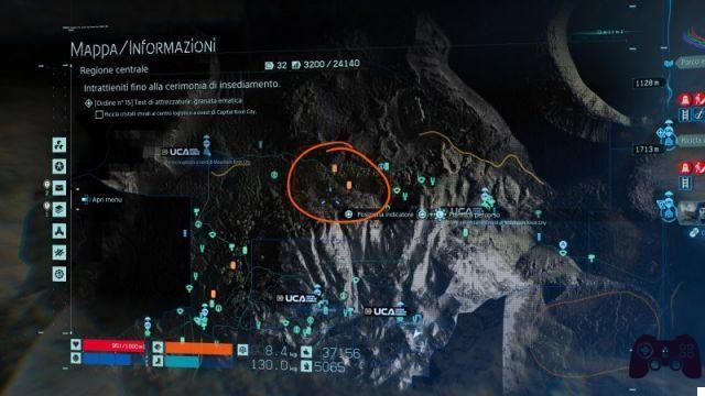
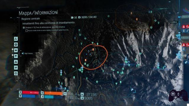
After passing the first game area of Death Stranding, Sam and the BB will arrive in Lake Knot City, the third city essential for the regular functioning of the chiral network. From now on, the map you will face will be much more varied and rich from an environmental point of view. The Eastern Region was a kind of tutorial to prepare you for this new playground, where "adaptation" is the key word. Follow us in this Death Stranding Central Region map guide, where we will show you the conformation of the terrain, the various hostile areas and all the points of interest that can help you survive and complete your deliveries.
Da Lake Knot City a South Knot City: il terreno
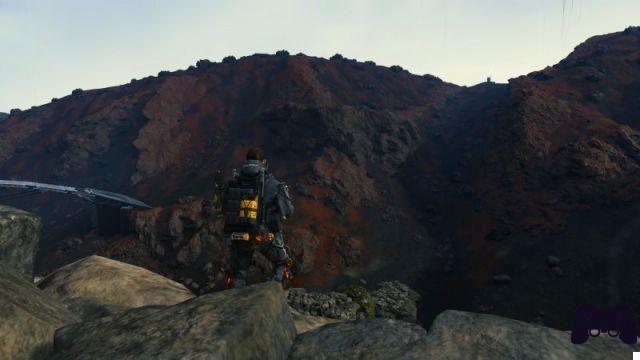
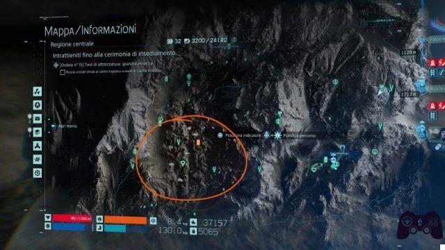
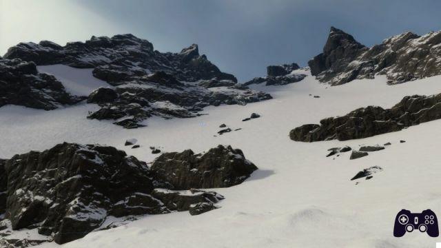
The first territory you will face will be the one that stands out between Lake Knot City e South Knot City. From the barren and arid territories at the gates of the coastal city you pass to "Martians" rough terrain, and then cross green grasslands, up to the ruins of long-forgotten cities.
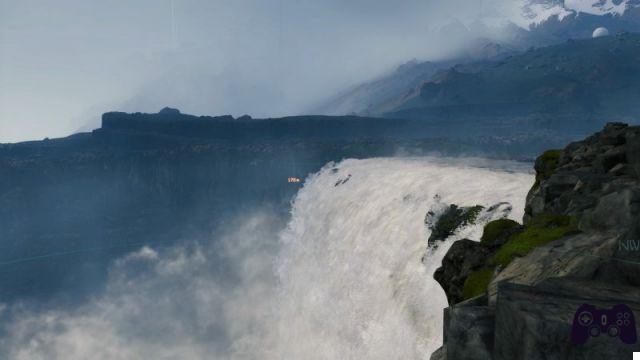
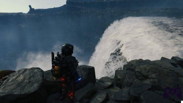
From the northern desert territories that lie on the borders of the Middle Knot City crater, small streams branch off which, as they flow into each other, lead to a flourishing but small predominance of vegetation on the surrounding territory. The resulting river becomes a huge waterfall in the south, a hundred meters high, which falls to the ground with relentless force. Here the vegetation gives way to rocky conformations with a curious and vaguely geometric shape. A little further east, a farm exploits the properties of the rain chronograph to produce raw materials that can help the survivors. Also to the south, a crater lake makes it possible to dispose of dangerous or damaged cargoes.
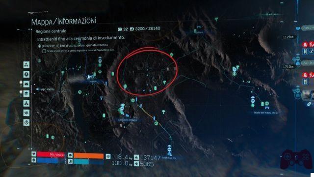
Da Lake Knot City a South Knot City: i territori dei MULI
In quest'area i territories of the MULES there are five. The first can be found just outside the "gates" of Lake Knot. It can only be avoided by passing through the desert area to the west, in the direction of the Middle Knot crater. Two others are located in the immediate vicinity. Due to the conformation of the terrain, very open and sometimes bumpy, it is advisable not to cross the fields of the MULES unless a mission obliges you to retrieve a load inside them. Once the highway takes shape (also thanks to the contribution of the other players) you can easily pass through the territory of the MULES. But be careful. If you go too slow (we have noticed that the van is slow compared to MULES even at maximum speed), it will not be difficult for them to block your vehicle with a spear.
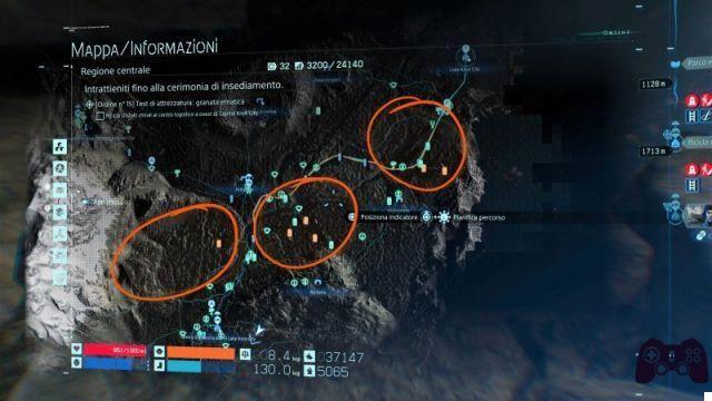
Fourth territory of the MULI is located directly below (looking at the map) to Logistics center south of Lake Knot City. This is by far the most interesting camp in the game, as it is surrounded by a very deep canyon. In some places you will need a ladder to cross the crevasse, but if you have the patience to search a little more carefully, you will surely find areas where the walls get close enough to allow the passage with a simple jump. Furthermore, this area allows you to use a non-trivial strategy. In fact, if we launch a load-bait into the canyon, the patrol MULES will activate to go looking for it, leaving the field free enough to allow us to pass safely.
The last territory is the one north of the Chronofattoria. The border is not too wide, so it won't be difficult for you to get around it from all sides, both on the mountain side and along the river bank.
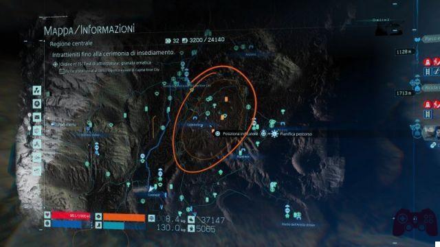
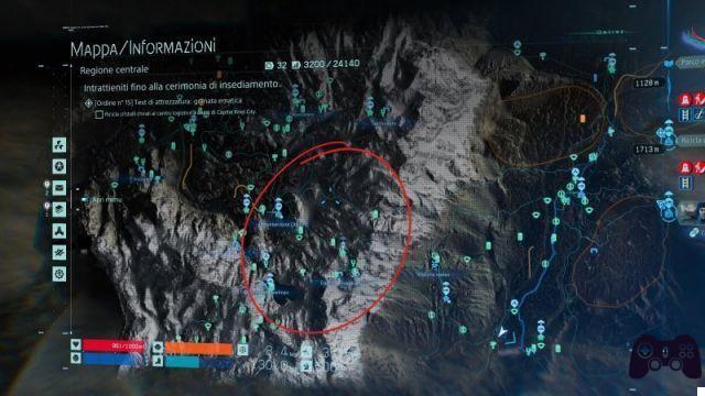
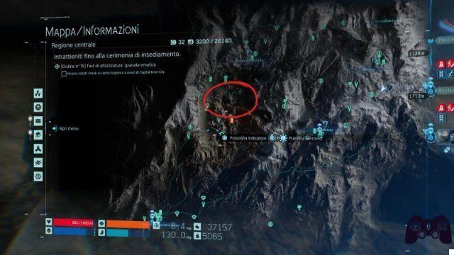
Da Lake Knot City a South Knot City: i territori delle CA
Le Central Regions of Death Stranding field a mechanic that was already present in the first area, but to a lesser extent. In fact, in this new region the rain time will fall much more randomly, making it impossible to predict too accurately the places infested by CA. However, it is possible to find a common thread that allows us to identify (without the "specific tool" that will be given to us later in the game) the main places where stranded creatures are usually present.
Undoubtedly, the area where the cronopioggia constantly falls is that of the urban ruins north of South Knot City. Here the CAs are many and the various buildings do not allow the identification of each of them in an immediate way. So, move slowly and stop as much as possible to analyze the surrounding situation.
Another place where it is always possible to find CA is near the crater of Middle Knot City, in the area of Ruined refuge. Here too, the buildings do not allow us to identify the CAs precisely, but the situation is much calmer.
The cronopioggia tends to fall often even at Chronofattoria, but we have never encountered stranded creatures in the area.
Finally, the presence of CA is also frequent among the Junk dealer and crater lake a nord di South Knot.
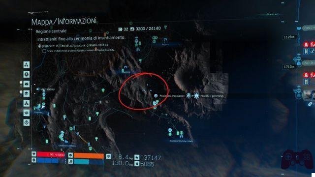
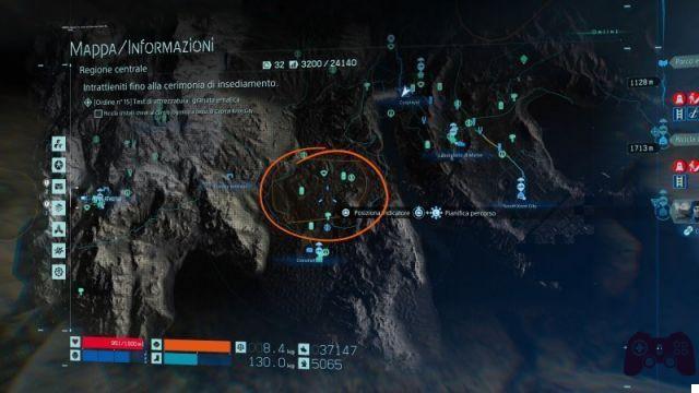
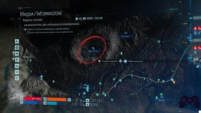
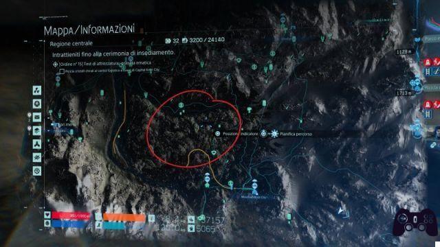
Da Lake Knot City a South Knot City: gli insediamenti
Lake Knot City: the city where Sam and BB disembark after crossing the Ground Zero lake;
Peter Englert: located west of Lake Knot City. He will often ask you to give him some pizza;
Ruined refuge: between Peter Englert (to the north-east) and the Artigiano (to the south). An old settlement, now haunted by CAs;
Craftsman: south of the Ruined Refuge;
Engineer: south of Lake Knot City, just beyond the first MULES camp;
Elder: it is located south of the central encampment of the MULI;
Logistics center south of Lake Knot City: north of the field of MULES in the canyon;
Collector: within the territory of the MULI south of the Logistics Center;
Movie director: east of the field of MULES in the canyon. Often hit by a beating rain storm;
Junk dealer: between the MULES camp in the canyon and the crater lake;
Chiral artist's studio: east of South Knot City, on the opposite shore of the crater lake;
Weather station: between the Logistics Center (to the north-east) and the waterfall (to the south-east)
Chronofattoria: south of the fifth MULI camp listed above;
Mama's workshop: among the CA-haunted ruins and South Knot City;
South Knot City: between the crater lake (to the east), Mama's Laboratory (to the northeast) and the river (to the west).
Mountain Knot City: il terreno
We advise to continue reading only to those who have passed chapter 5 to avoid running into possibilities spoiler, although, for those who don't want to have any anticipation on the pitch, it would be better to have completed the entire campaign.
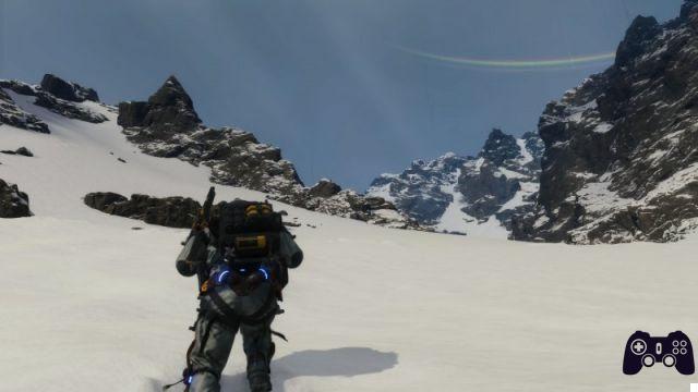
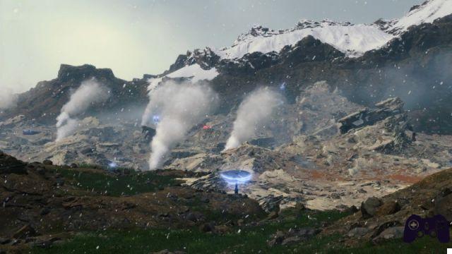
With the territory of Mountain Knot City we include the whole western area of the map. As a result, the playing field is extremely varied. To the north, mist-covered stagnant plains stretch out for several hundred meters, reaching the foothills of the mountain range that gives the Mountain Knot its name. Here the snow falls abundantly, damaging the load even more than the rain show, since it sticks to it until it is melted by the sun's rays. From the snowy and steep peaks you reach a volcanic, sulphurous territory, characterized by steaming calderas. The yellowish ground makes the atmosphere gloomy and "toxic". At the center of it all is a snow-shrouded lake, the icy "heart" of the new America.
Mountain Knot City: i territori dei MULI
Reached the slopes of Mountain Knot City, you will find yourself face to face for the first time with a new type of MULES: the terrorists. These, armed to the teeth, will not hesitate to shoot at you if you are spotted. The first meeting will most likely take place north of the mountain, in the forest between Logistics center north of Mountain Knot City (to the west) and the Secondary station north of Mountain Knot City (East). The territory is very narrow, so it is possible to get around the area passing through the mountain, even if you will need several ladders and climbing ropes, as the side is quite steep and steep.
A further camp is located between the Logistic center e Mountain Knot, in the marshy area. The streams here are several, although not too deep. However, pay attention to the vigor, so as not to be caught unprepared in case you have to escape quickly from the area. A point in favor for the player is the presence of a lot of tall grass in which to hide. The area covered by the stakes is very large, but it shouldn't be a problem to go around it to the west, as long as you have tools to help you navigate the wide, deep waterways.
The last territory of the MULES in the area is the one south of the settlement of Evolutionary biologist and west of that of Paleontologist. Going through this area is a must if you have to reach the Chiral repeater south of the map. However, it is not difficult to evade the sensor posts if you stay on the rock face west of the camp. Furthermore, at a certain point, to the west (still looking at the map) you will also find a passage through the mountain that will allow you to reach the repeater in complete tranquility.
Mountain Knot City: the territories of the CA
Again, CA-infested locations tend to vary, especially in the mountains, where a few times we've encountered Stranded Creatures in the same spot. Usually, the central area of the mountain range is the one most affected by crononeve. Consequently, the paths you will find yourself on will have to be very varied if your intent is to avoid a clash with the CAs. Once in this area, you should have unlocked the ability to predict the weather through the map, so always plan your route first, paying particular attention to atmospheric conditions.
One area where it usually rains is the one immediately preceding Mountain Knot, on the banks of the stream to the north, where there are also what appear to be the remains of an ancient iron structure. Going through the mountain without going too far into the valley will allow you to easily get around the problem.
The only place we've ever found CA in this area of the region is here volcanic zone south of the settlement of Evolutionary biologist. Here you will have to be very careful because, in addition to the normal CAs, there are also larger entities that seem to "hold the reins" of the latter. To complete a main mission of the game, you will have to venture into this area, which is probably one of the most creepy and frightening in the game.
Mountain Knot City: the settlements
Secondary station north of Mountain Knot City: located between the Craftsman and the Logistics Center north of Mountain Knot City;
Logistics center north of Mountain Knot City: located in the north of the region, between the field of MULES in the woods (to the east) and the one in the swamp (to the south);
Son of the writer: located south-east of the Logistics Center;
Mountaineer: located on the mountain north of Mountain Knot;
Spiritualist: just east of the Montanaro. Easily identifiable thanks to the elevated position and the two monoliths under which the structure is located;
Photographer: west of Mountain Knot and not far from the MULES camp in the swamp;
Mountain Knot City: the third city of the central region, is located on the slopes of the mountain. To the north is the Montanaro, to the west the Photographer, to the south the Doctor and to the east the Botany Expert;
Doctor: is located south of Mountain Knot. You will probably already find a path paved by other players that will lead you to it without any particular problems;
Botany expert: located east of Heartman's Laboratory. Nearby you can find a thermal spring;
Heartman's laboratory: one of the central nodes of the main campaign, as well as one of the few buildings different from what we have seen so far. It can be easily identified on the map thanks to the large heart-shaped lake at the foot of it;
Geologist: located southeast of Heartman's Laboratory;
Paleontologist: southwest of the Geologist. A little further south you can find a volcanic area;
Evolutionary biologist: west of the Geologist and north of the CA-infested volcanic territory;
Veteran courier: north-west of the Cronofattoria, on the slopes of the mountain;
Chiral repeater: the southernmost structure of the Central Region, as well as the last node of it. Beyond there is only a sea of tar.
Advice on how to move around the Central Region
If you have to go to the mountains, equip yourself with different ladders and climbing ropes: Unlike the Eastern Region, in the mountains a couple of ladders and ropes will not be enough to cross the difficult terrain, unless you intend to find an alternative route that allows you to pass in peace, but which will take you away. only minutes, but also hours of play. Consequently, it is always good to have as many ladders and ropes as possible with you, also because the chrononeve will make them unusable in the blink of an eye. If, on the other hand, you are in the east, in the first part of the map, you can also do without it, since the predominantly flat structure of the territory allows a complex passage. Another matter for the waterfall area. It is always advisable to have at least a couple of climbing ropes to avoid falling off a ravine while trying to descend at the "best".
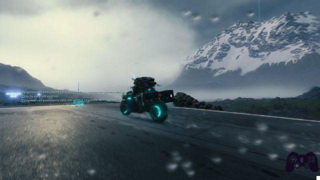
Always carry at least one hovercar with you: even if you intend to take a vehicle, always equip yourself with a hovercar. So, even if the vehicle's battery runs out or the ground prevents the passage, you will still have a support that can carry up to 300 kg without Sam accusing the weight. In addition, in mountain areas it is ideal to allow you to move more easily through deep snow.
Use the multi-terrain eskeleton: When unlocked, always use the multi-terrain exoskeleton. This is because the hovercar will take care of the excess weight, while the speed that the fast exoskeleton provides will not be too useful if you carry a load on your back. The multi-terrain exoskeleton, on the other hand, allows you to move faster on snow and in waterways, not letting Sam's stamina drop. In addition, it will ensure greater stability on all terrains. The battery discharges quickly, but never as fast as that of the rapid exoskeleton. To remedy this lack, attach an additional battery to your backpack (you can change the objects placed on the backpack in your private room).
Help build the highway: Probably the highway is the most useful facility in the whole region. It allows you to connect the various Knot Cities and guarantees a quick and safe route to each of them, greatly facilitating the work of couriers. Since it is a structure, the vehicle's battery will not wear out when you enter its network, another incentive to carry it out. Different materials will be needed to complete each stretch, so if you find any on the street, don't bring them back to one of the settlements, but use them for the construction of the road fabric. They will be much more useful here than collecting dust in some warehouse.
Do not use vehicles unless you need to cross the motorway: If you have to travel a long stretch of road not previously traveled, it is advisable to first cross it on foot to understand how the ground evolves under your feet. Since there are so many biomes and they follow each other very quickly, it is difficult to predict the path that you will be able to travel on board a vehicle. The risk is that of not being able to pass through a crevasse or because the rock formations do not allow it. Finding alternative routes will only waste your time and battery. Once the latter is finished, you will be back to the starting point, with the only difference that you will not be able to equip yourself adequately for a walk, but you will have to make do with the tools you have brought with you.
 Death Stranding ps4
- ps4
- pc
Exit date: November 8, 2019